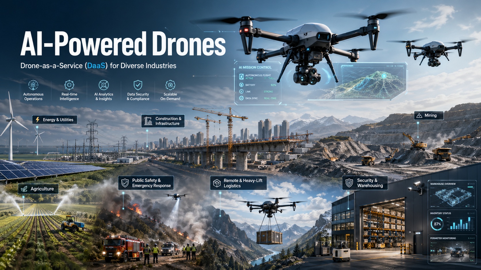
AI-Powered Industrial Intelligence
Advanced AI-powered drones on a flexible subscription or pay-per-use basis — enterprise-grade aerial intelligence without the capital expense.
At Savage Consulting, we bring together strategic business expertise and next-generation drone technology to help you work smarter, faster, and safer. Our Drone-as-a-Service (DaaS) model delivers advanced AI‑powered drones on a flexible subscription or pay‑per‑use basis — so you get enterprise‑grade aerial intelligence without the capital expense, operational burden, or regulatory complexity of owning and running your own fleet.
We are your single point of contact for fully autonomous inspections, LiDAR‑based 3D digital mapping, and real‑time AI analytics. Whether you need to monitor a power line, survey a mine site, or manage warehouse inventory, our drones collect the data and our AI turns it into actionable insights — all integrated seamlessly with your existing workflows.
Autonomous Asset Health at Scale
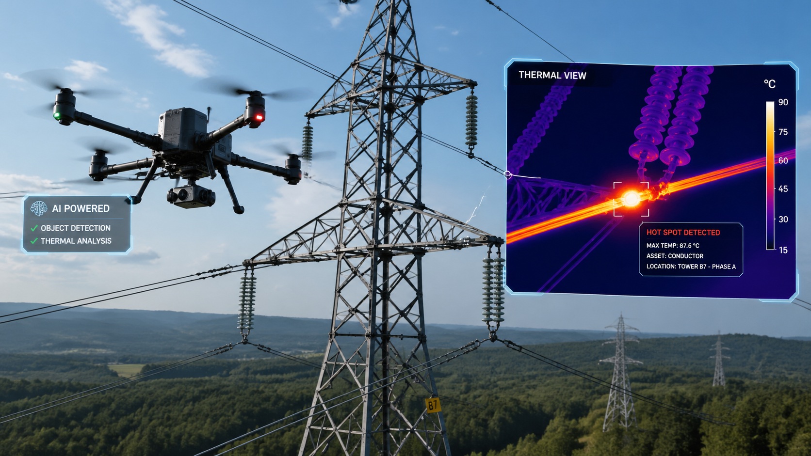
For the energy and utilities sector, asset reliability is everything. Our DaaS offering brings autonomous, AI‑enabled inspections to your entire infrastructure — from solar farms and wind turbines to transmission lines, substations, and pipelines.
Equipped with high‑resolution thermal, multispectral, and LiDAR sensors, our drones capture detailed real‑time data of every component. Onboard AI and advanced computer vision algorithms instantly detect anomalies: panel cracks, thermal hotspots, string failures, corrosion, or vegetation encroachment. Inspection reports are generated in minutes — not days — giving you the speed to intervene before a minor fault becomes a costly outage.
Our service is built on predictive maintenance intelligence. By integrating drone data with your asset management system, we help you transition from reactive repairs to proactive, condition‑based maintenance. This reduces downtime, optimises energy output, and extends the lifespan of your infrastructure — all while keeping your engineers safely on the ground.
Survey‑Grade Mapping, Progress Tracking, and Safety Compliance
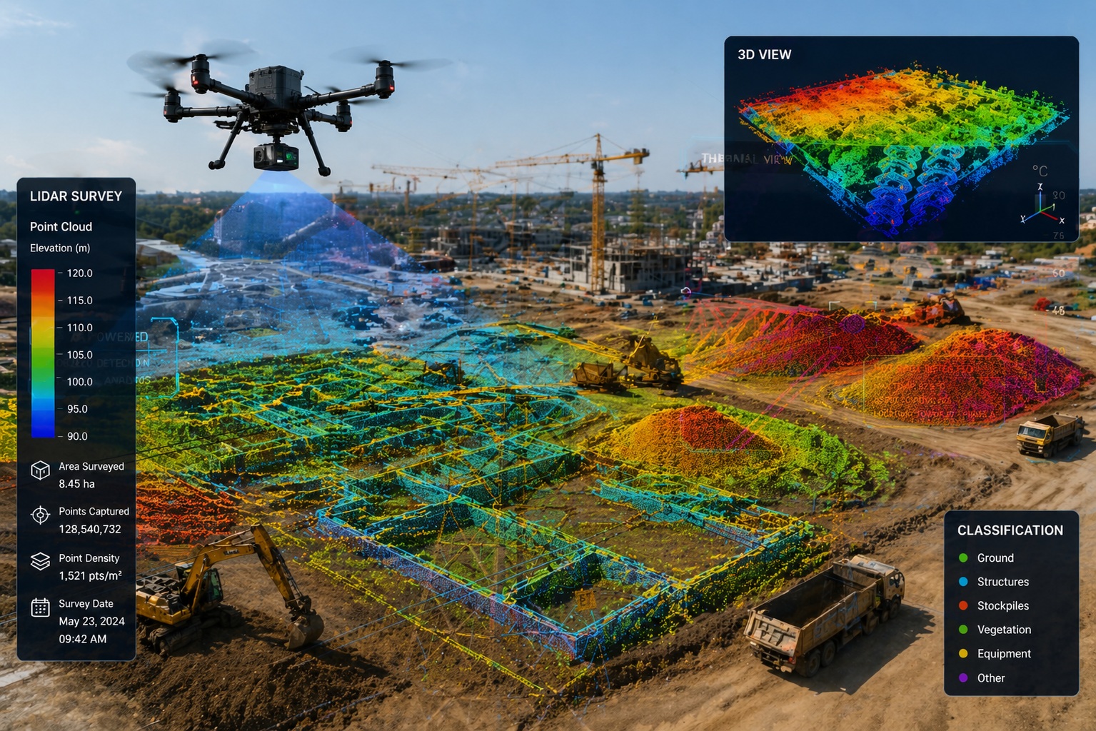
From skyscrapers to bridges, tunnels to highways — our AI‑powered drones transform the way you plan, monitor, and manage construction projects.
We deploy drones equipped with high‑resolution cameras and LiDAR sensors to swiftly capture detailed aerial imagery and topographic data of your site. Our AI‑driven platform then converts this raw data into survey‑grade 3D models, digital elevation models (DEMs), and orthomosaic maps — deliverables that give you centimetre‑level accuracy for earthwork calculations, site planning, and infrastructure design.
Beyond mapping, our autonomous Progress AI agent analyses site data 100 times faster than manual walkthroughs, automatically comparing as‑built against as‑planned to flag delays and deviations. Our Safety AI agent identifies hazards — from missing guardrails to unsafe material stacking — and verifies when they are resolved. Real‑time progress dashboards and automated compliance reports keep stakeholders aligned and projects on schedule.
Stockpile Accuracy, Slope Stability, and Geotechnical Intelligence
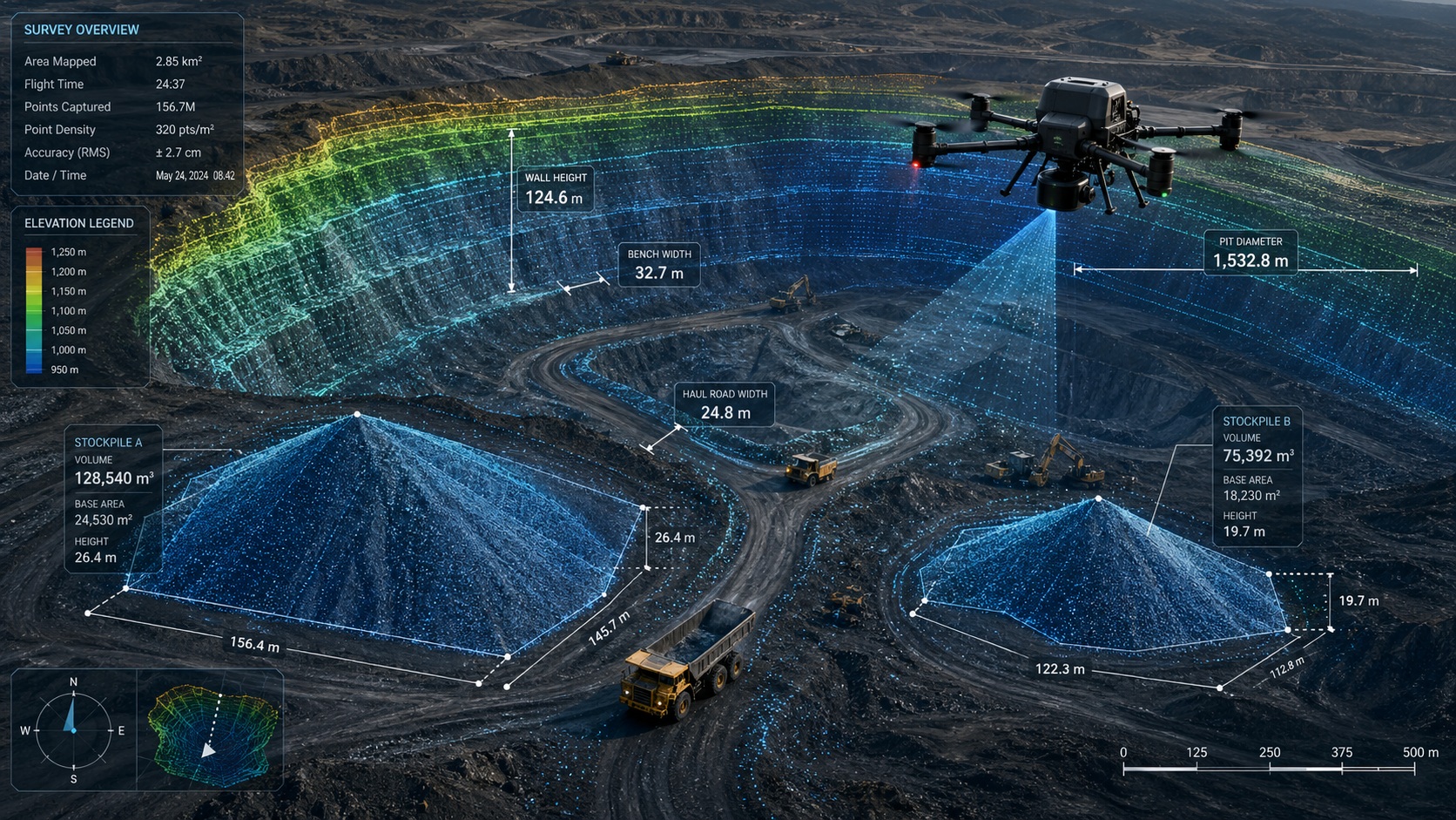
In mining, precision and safety are non‑negotiable. Our DaaS solution replaces dangerous manual surveys with rapid, autonomous overflights that deliver auditable, centimetre‑accurate data.
Using RTK‑enabled drones with LiDAR and high‑overlap photogrammetry, we can survey stockpiles up to 10 times faster than traditional rover methods, with volumetric accuracy within ±2.6% of a tape‑and‑total‑station survey. Our weekly or daily flights transform inventory from a quarterly accounting headache into a live operational KPI — aligning crusher throughput with real demand and reducing costly write‑offs.
Beyond stockpiles, our AI‑powered slope stability monitoring performs regular 3D scans of pit walls to detect early signs of ground movement, supporting proactive geotechnical risk management. For exploration, our multispectral and LiDAR sensors map surface mineral signatures and penetrate vegetation to reveal bare‑earth terrain. All data integrates seamlessly with your ERP and compliance reporting systems.
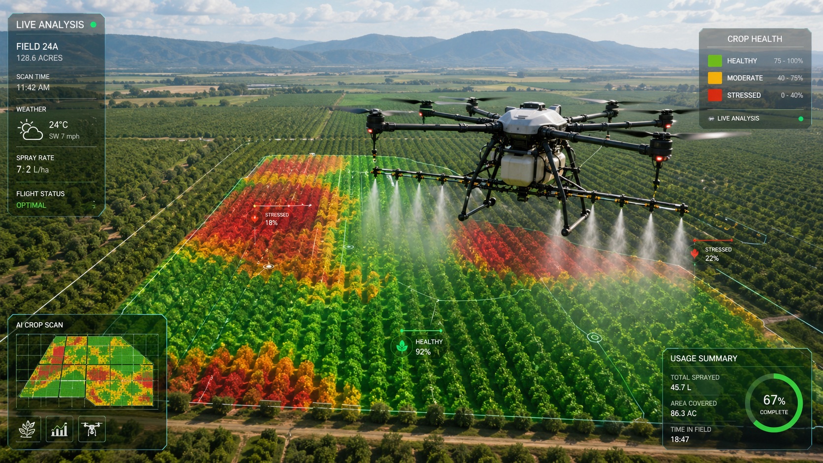
Precision Spraying, Crop Health Monitoring, and Yield Optimisation
Modern agriculture demands data‑driven precision. Our agricultural DaaS delivers autonomous, RTK‑guided drones that both monitor and act — turning every operational flight into a source of agronomic intelligence.
Conventional drone spraying requires manual pre‑mission mapping of each field, a process that becomes a bottleneck at industrial scale. Our AI Vision system removes that requirement, using real‑time perception of canopy height, terrain features, and crop structure during flight — combined with centimetre‑accurate RTK positioning — to adjust altitude and spray rates autonomously. This "map‑free" approach allows us to redeploy immediately after replanting or field reconfiguration, covering thousands of hectares without interruption.
Beyond spraying, each mission feeds into our AI Smart Farming backend, providing: canopy density and uniformity analysis, crop stress and anomaly detection, spray effectiveness validation, and terrain profiling. We offer an integrated "spray + intelligence" solution — so you apply inputs only where needed, reduce chemical waste, and maximise yield per hectare.
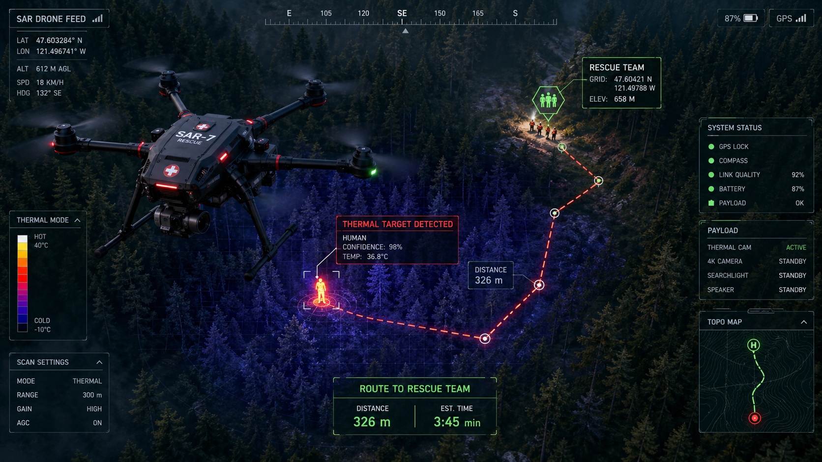
Search & Rescue, Wildfire Detection, and Disaster Response
When minutes save lives, our rapid‑deployment drones provide critical situational awareness for first responders, emergency managers, and public safety agencies.
Our drones are equipped with advanced infrared (IR) cameras, visible‑spectrum imaging, LiDAR sensors, and onboard AI powered by high‑performance edge processors. Machine learning algorithms analyse environmental data — temperature, wind speed, vegetation conditions — to predict fire outbreaks and simulate wildfire spread in real time. Evacuation routes are computed dynamically using pathfinding algorithms, adapting instantly as conditions change.
For search and rescue, AI‑assisted thermal imaging and radar systems detect victims in low‑visibility, smoke‑obscured, or dense terrain, transmitting precise GPS coordinates to ground teams. Our fleet can also deliver emergency supplies — water, medical kits, or communications equipment — directly to cut‑off individuals.
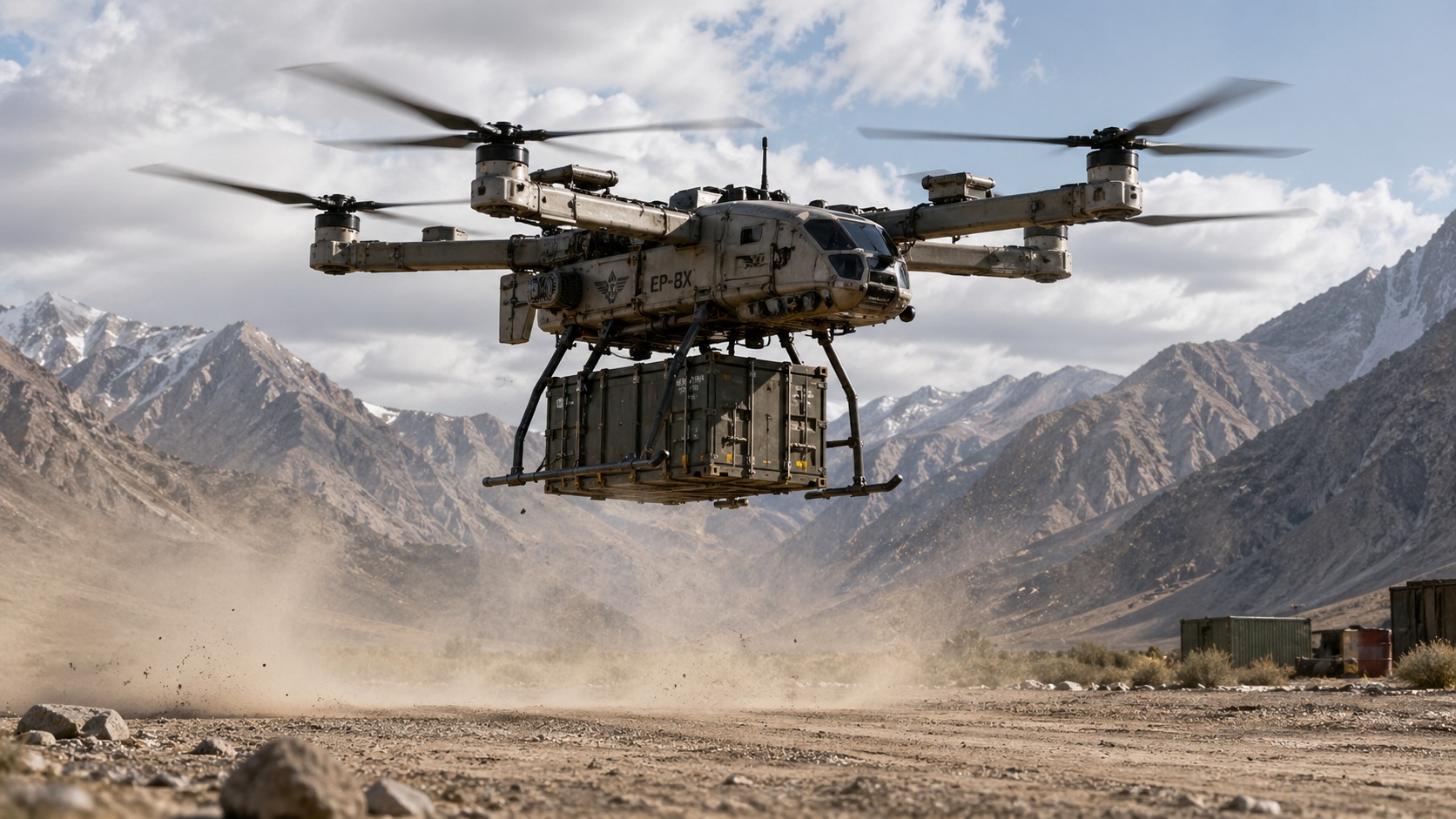
Autonomous Cargo Transport Beyond the Reach of Roads
For remote operations, infrastructure‑limited regions, and emergency logistics, traditional supply chains fail. Our heavy‑lift DaaS delivers autonomous, long‑range cargo transport that bypasses the need for runways, ground crews, or multi‑million‑dollar infrastructure.
Our fleet includes autonomous VTOL heavy‑lift platforms capable of carrying payloads from 50 kg to 250 kg over distances of up to 1,000 km without refuelling. These drones take off and land on dirt roads, gravel pads, or short clearings — not airports — bringing logistics to where infrastructure simply does not exist.
Typical applications include: resupply of remote mining camps and offshore platforms, mid‑mile delivery for humanitarian aid and disaster relief, maritime resupply to vessels at anchor, and rapid deployment of medical supplies to isolated communities. Enhanced autonomy and flight logic enable repeatable mission execution with minimal human intervention.
Automated Inventory Counting, Surveillance, and Safety Inspections
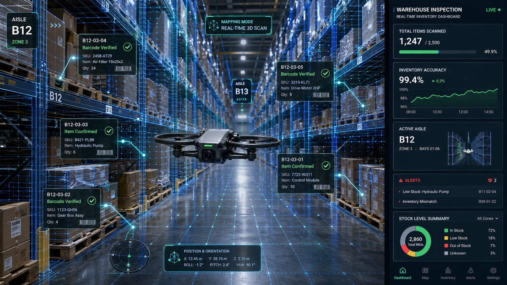
Inside your warehouse or distribution centre, our compact AI‑powered indoor drones work autonomously — improving accuracy, safety, and operational visibility without disrupting your workflow.
Our indoor DaaS solution uses drones equipped with 4K cameras, barcode / QR scanning, obstacle avoidance, and onboard AI to perform automated cycle counting, real‑time inventory checks, facility mapping, and surveillance patrols. The drones navigate safely through narrow aisles and confined spaces using AI‑generated 3D maps of the facility.
The results are transformative: inventory accuracy increases through continuous cycle counting; discrepancies between physical stock and your WMS are flagged immediately; and workers are kept out of dusty, confined, or hazardous areas, reducing safety risks. The data integrates directly with your existing warehouse management system, turning manual, labour‑intensive tasks into a fully automated, real‑time intelligence loop.
Why Savage Consulting?
Drone‑as‑a‑Service (DaaS) model
Pay per use or subscribe, with zero capital outlay.
AI‑powered analytics
Not just raw data, but actionable insights.
End‑to‑end service
We manage the hardware, pilots, compliance, data processing, and system integration.
Industry‑agnostic expertise
From energy and mining to agriculture and logistics, we speak your language.
Global reach
Deployable anywhere regulations allow.
Ready to Elevate Your Operations?
Contact Savage Consulting today to schedule a free consultation and discover how our advanced AI‑powered drones can transform your business.
Schedule a Free Consultation